
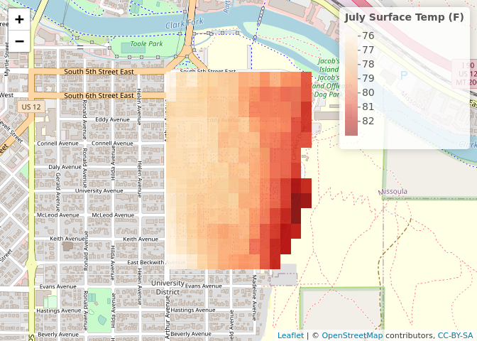
Summer heat at the University of Montana using Land Surface Temperature from ECOSTRESS
Interested in extracting wildfire boundaries using Google Earth Engine? Check out this code.
AppEEARS (in progress) This tutorial tutorial uses the wildfire boundaries extracted from the Google Earth Engine code (above) and uses the AppEEARS API to get ECOSTRESS Land Surface Temperature.
During my time as a Data Science Fellow at the National Center for Ecological Analysis and Synthesis (NCEAS) I helped out with the State of Alaskan Salmon and People project This notebook looks at impacts to fish passage in Alaska.
Glacial Lake Watershed Analysis with RGEE This code uses the R’s API Google Earth Engine interface to extract Gross Primary Production (GPP) from several watersheds in northwestern Montana. This code was developed to help a fellow labmate that researches glacial lake formation. Notebook coming soon!